(1 of 6) ...The Flood Warning is extended for the following rivers in Texas... Neches River Near Alto affecting Anderson, Cherokee, Angelina and Houston Counties. ...The Flood Warning continues for the following rivers in Texas... Neches River Near Diboll affecting Polk, Angelina and Trinity Counties. Neches River Near Neches affecting Anderson and Cherokee Counties. For the Neches River...including Neches, Alto, Diboll, Rockland... Minor flooding is forecast. * WHAT...Minor flooding is occurring and minor flooding is forecast. * WHERE...Neches River near Alto. * WHEN...Until Saturday evening. * IMPACTS...At 16.0 feet, Boat ramps and picnic areas near the river will begin to flood. Ranchers should move cattle and equipment near the river to higher ground. * ADDITIONAL DETAILS... - At 8:15 PM CDT Sunday the stage was 16.7 feet. - Bankfull stage is 16.0 feet. - Recent Activity...The maximum river stage in the 24 hours ending at 8:15 PM CDT Sunday was 16.9 feet. - Forecast...The river is expected to fall below flood stage Friday morning and continue falling to 15.9 feet Friday evening. - Flood stage is 16.0 feet. - Flood History...This crest compares to a previous crest of 16.8 feet on 11/01/2013. - http://www.weather.gov/safety/flood (2 of 6) ...The Flood Warning is extended for the following rivers in Texas... Neches River Near Alto affecting Anderson, Cherokee, Angelina and Houston Counties. ...The Flood Warning continues for the following rivers in Texas... Neches River Near Diboll affecting Polk, Angelina and Trinity Counties. Neches River Near Neches affecting Anderson and Cherokee Counties. For the Neches River...including Neches, Alto, Diboll, Rockland... Minor flooding is forecast. * WHAT...Minor flooding is occurring and minor flooding is forecast. * WHERE...Neches River near Diboll. * WHEN...Until further notice. * IMPACTS...At 12.0 feet, Minor lowland flooding occurs. Expect flooded boat ramps and trails. * ADDITIONAL DETAILS... - At 8:15 PM CDT Sunday the stage was 12.2 feet. - Bankfull stage is 12.0 feet. - Recent Activity...The maximum river stage in the 24 hours ending at 8:15 PM CDT Sunday was 12.2 feet. - Forecast...The river is expected to rise to a crest of 12.4 feet Tuesday evening. - Flood stage is 12.0 feet. - Flood History...This crest compares to a previous crest of 12.6 feet on 03/24/1970. - http://www.weather.gov/safety/flood (3 of 6) ...The Flood Warning is extended for the following rivers in Texas... Neches River Near Alto affecting Anderson, Cherokee, Angelina and Houston Counties. ...The Flood Warning continues for the following rivers in Texas... Neches River Near Diboll affecting Polk, Angelina and Trinity Counties. Neches River Near Neches affecting Anderson and Cherokee Counties. For the Neches River...including Neches, Alto, Diboll, Rockland... Minor flooding is forecast. * WHAT...Minor flooding is occurring and minor flooding is forecast. * WHERE...Neches River near Neches. * WHEN...Until further notice. * IMPACTS...At 14.0 feet, Minor lowland flooding. Move livestock and equipment to higher ground away from the river. * ADDITIONAL DETAILS... - At 8:30 PM CDT Sunday the stage was 14.1 feet. - Bankfull stage is 12.0 feet. - Recent Activity...The maximum river stage in the 24 hours ending at 8:30 PM CDT Sunday was 14.2 feet. - Forecast...The river is expected to rise to a crest of 14.3 feet tomorrow morning. - Flood stage is 12.0 feet. - Flood History...This crest compares to a previous crest of 14.4 feet on 06/06/2017. - http://www.weather.gov/safety/flood (4 of 6) ...The Flood Warning continues for the following rivers in Texas... Angelina River Near Lufkin affecting Nacogdoches and Angelina Counties. For the Angelina River...including Alto, Lufkin...Minor flooding is forecast. * WHAT...Minor flooding is occurring and minor flooding is forecast. * WHERE...Angelina River near Lufkin. * WHEN...Until further notice. * IMPACTS...At 162.0 feet, Minor lowland to diminish and end on the lower Angelina River. * ADDITIONAL DETAILS... - At 8:45 PM CDT Sunday the stage was 162.2 feet. - Bankfull stage is 158.5 feet. - Recent Activity...The maximum river stage in the 24 hours ending at 8:45 PM CDT Sunday was 162.2 feet. - Forecast...The river is expected to rise to a crest of 163.3 feet Thursday morning. - Flood stage is 161.0 feet. - Flood History...No available flood history. - http://www.weather.gov/safety/flood (5 of 6) ...The Flood Warning continues for the following rivers in Texas... Trinity River at Riverside affecting Polk, Trinity, San Jacinto and Walker Counties. Navasota River near Normangee affecting Madison, Brazos and Grimes Counties. For the Trinity River...including Riverside...Minor flooding is forecast. For the Navasota River...including Normangee...Minor flooding is forecast. * WHAT...Minor flooding is occurring and minor flooding is forecast. * WHERE...Navasota River near Normangee. * WHEN...Until Tuesday afternoon. * IMPACTS...At 15.0 feet, Minor lowland flooding begins as water escapes the main channel and inundates the floodplain. * ADDITIONAL DETAILS... - At 6:00 PM CDT Sunday the stage was 15.8 feet. - Bankfull stage is 12.0 feet. - Recent Activity...The maximum river stage in the 24 hours ending at 6:00 PM CDT Sunday was 16.1 feet. - Forecast...The river is expected to fall below flood stage early Tuesday morning and continue falling to 12.6 feet Friday evening. - Flood stage is 15.0 feet. - Flood History...This crest compares to a previous crest of 15.9 feet on 03/12/2010. - http://www.weather.gov/safety/flood (6 of 6) ...The Flood Warning continues for the following rivers in Texas... Trinity River at Riverside affecting Polk, Trinity, San Jacinto and Walker Counties. Navasota River near Normangee affecting Madison, Brazos and Grimes Counties. For the Trinity River...including Riverside...Minor flooding is forecast. For the Navasota River...including Normangee...Minor flooding is forecast. * WHAT...Minor flooding is occurring and minor flooding is forecast. * WHERE...Trinity River at Riverside. * WHEN...Until Friday evening. * IMPACTS...At 134.0 feet, Minor lowland flooding continues with the boat ramp in the Deep River Plantation Subdivision in Walker County inundated. Backwater flooding up Thomas Lake in Walker County floods the boat ramp in the Green Rich Shores Subdivision in Walker County. At 135.0 feet, Minor lowland flooding continues as significant backwater up Thomas Lake floods the lowest areas in the Green Rich Shore Subdivision in Walker County with the boat ramp completely inundated. The lowest lying areas in the Deep River Plantation Subdivision and FM 980 northwest of Riverside are threatened. * ADDITIONAL DETAILS... - At 7:30 PM CDT Sunday the stage was 134.8 feet. - Bankfull stage is 133.0 feet. - Recent Activity...The maximum river stage in the 24 hours ending at 7:30 PM CDT Sunday was 134.8 feet. - Forecast...The river is expected to fall below flood stage Friday morning and continue falling to 133.3 feet Friday evening. - Flood stage is 133.5 feet. - Flood History...This crest compares to a previous crest of 134.8 feet on 11/25/2004. - http://www.weather.gov/safety/flood
honey pot Conroe, Texas, 442.125, WM5E Repeater

Conroe, TX

WM5E
Repeater ID: 48-1019

Downlink: 442.12500
Uplink: 447.12500
Offset: +5.000 MHz
Uplink Tone: 123.0
County: Montgomery
Call: WM5E
Use: OPEN
Op Status: OFF-AIR Off-Air
Coverage:
Features: Emergency power equipped.
FM: Yes; analog capable: 25.0 kHz (wideband)
Coordination: TVHFS
Last updated: 2012-04-28
Last reviewed: 2023-10-01
Marker
50 km
30 mi
Leaflet © OSM contributors

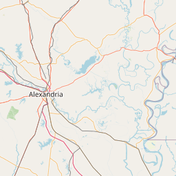
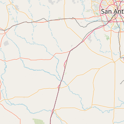
Exact coordinates of the repeater are not known.
Coverage circle based on mobile coverage and ignores propagation anomalies and terrain.

Signal Reports (click map icon for details): Base Mobile HT
Add a Signal Report


Call Date Details
WRUH411 (registered) 2023-10-01 Reported off-air.