(1 of 3) ...The National Weather Service in Springfield MO has issued a Flood Warning for the following rivers in Missouri... Marmaton River near Nevada affecting Vernon County. For the Marmaton River...including Nevada...Minor flooding is forecast. * WHAT...Minor flooding is forecast. * WHERE...Marmaton River near Nevada. * WHEN...From Monday afternoon to early Wednesday morning. * IMPACTS...At 20.0 feet, minor flooding occurs near the gage site and affects low lying areas along the river. * ADDITIONAL DETAILS... - At 7:45 PM CDT Sunday the stage was 13.7 feet. - Bankfull stage is 20.0 feet. - Forecast...The river is expected to rise above flood stage early tomorrow afternoon to a crest of 20.6 feet tomorrow evening. It will then fall below flood stage early Tuesday morning. - Flood stage is 20.0 feet. - Flood History...This crest compares to a previous crest of 20.6 feet on 11/02/2013. - http://www.weather.gov/safety/flood (2 of 3) ...The Flood Warning continues for the following rivers in Missouri... Sac River near Caplinger Mills affecting Cedar County. Osage River at Taberville affecting St. Clair and Vernon Counties. For the Osage River...including Taberville...Minor flooding is forecast. For the Sac River...including Caplinger Mills...Moderate flooding is forecast. * WHAT...Minor flooding is occurring and minor flooding is forecast. * WHERE...Osage River at Taberville. * WHEN...Until Wednesday afternoon. * IMPACTS...At 26.0 feet, the main road of the Schell Osage Conservation Area floods west of the conservation office. The north campground main road of the Schell Osage Conservation area floods. * ADDITIONAL DETAILS... - At 7:45 PM CDT Sunday the stage was 25.6 feet. - Bankfull stage is 23.0 feet. - Recent Activity...The maximum river stage in the 24 hours ending at 7:45 PM CDT Sunday was 26.7 feet. - Forecast...The river is expected to fall below flood stage Tuesday afternoon and continue falling to 19.4 feet Friday evening. - Flood stage is 23.0 feet. - Flood History...This crest compares to a previous crest of 25.6 feet on 12/18/2015. - http://www.weather.gov/safety/flood (3 of 3) ...The Flood Warning continues for the following rivers in Missouri... Sac River near Caplinger Mills affecting Cedar County. Osage River at Taberville affecting St. Clair and Vernon Counties. For the Osage River...including Taberville...Minor flooding is forecast. For the Sac River...including Caplinger Mills...Moderate flooding is forecast. * WHAT...Minor flooding is occurring and moderate flooding is forecast. * WHERE...Sac River near Caplinger Mills. * WHEN...From this evening to early Thursday morning. * IMPACTS...At 20.0 feet, flood waters affect low lying areas near the river including farmland along Highway N and between Highway W and Caplinger Mills. Cedar Creek...a tributary of the Sac River backwaters and floods portions of Highway 39 and south of Cedar Springs. * ADDITIONAL DETAILS... - At 7:45 PM CDT Sunday the stage was 16.4 feet. - Bankfull stage is 16.0 feet. - Recent Activity...The maximum river stage in the 24 hours ending at 7:45 PM CDT Sunday was 16.4 feet. - Forecast...The river is expected to rise to a crest of 20.4 feet early tomorrow afternoon. It will then fall below flood stage early Wednesday morning. - Flood stage is 16.0 feet. - Flood History...This crest compares to a previous crest of 20.4 feet on 03/20/2020. - http://www.weather.gov/safety/flood
honey pot Moberly, Missouri, 443.975, K0MOB Repeater

Moberly, MO

K0MOB
Repeater ID: 29-10641

Downlink: 443.97500
Uplink: 448.97500
Offset: +5.000 MHz
Uplink Tone: CSQ
Downlink Tone: CSQ
County: Randolph
Call: K0MOB
Use: OPEN
Op Status: ON-AIR On-Air
Coverage:
Sponsor: Tri-County ARC
FM: Yes; analog capable: 25.0 kHz (wideband)
Nets: Tri-County ARC UHF: Tue at 20:00.
Last updated: 2021-07-27
Last reviewed: 2024-07-13
Marker
30 km
20 mi
Leaflet © OSM contributors

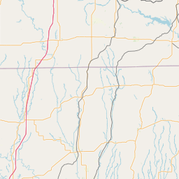
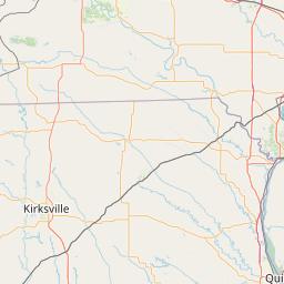
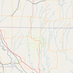
Exact coordinates of the repeater are not known.
Coverage circle based on mobile coverage and ignores propagation anomalies and terrain.

Signal Reports (click map icon for details): Base Mobile HT
Add a Signal Report


Date Information Updated
2021-01-29 16:26:42 US-24 coverage added.
2013-11-11 00:00:00 Added repeater

Call Date Details
AD0JA (registered) 2024-07-13 Reported on-air.