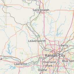
(1 of 3) ...The National Weather Service in Springfield MO has issued a Flood Warning for the following rivers in Missouri... Marmaton River near Nevada affecting Vernon County. For the Marmaton River...including Nevada...Minor flooding is forecast. * WHAT...Minor flooding is forecast. * WHERE...Marmaton River near Nevada. * WHEN...From Monday afternoon to early Wednesday morning. * IMPACTS...At 20.0 feet, minor flooding occurs near the gage site and affects low lying areas along the river. * ADDITIONAL DETAILS... - At 7:45 PM CDT Sunday the stage was 13.7 feet. - Bankfull stage is 20.0 feet. - Forecast...The river is expected to rise above flood stage early tomorrow afternoon to a crest of 20.6 feet tomorrow evening. It will then fall below flood stage early Tuesday morning. - Flood stage is 20.0 feet. - Flood History...This crest compares to a previous crest of 20.6 feet on 11/02/2013. - http://www.weather.gov/safety/flood (2 of 3) ...The Flood Warning continues for the following rivers in Missouri... Sac River near Caplinger Mills affecting Cedar County. Osage River at Taberville affecting St. Clair and Vernon Counties. For the Osage River...including Taberville...Minor flooding is forecast. For the Sac River...including Caplinger Mills...Moderate flooding is forecast. * WHAT...Minor flooding is occurring and minor flooding is forecast. * WHERE...Osage River at Taberville. * WHEN...Until Wednesday afternoon. * IMPACTS...At 26.0 feet, the main road of the Schell Osage Conservation Area floods west of the conservation office. The north campground main road of the Schell Osage Conservation area floods. * ADDITIONAL DETAILS... - At 7:45 PM CDT Sunday the stage was 25.6 feet. - Bankfull stage is 23.0 feet. - Recent Activity...The maximum river stage in the 24 hours ending at 7:45 PM CDT Sunday was 26.7 feet. - Forecast...The river is expected to fall below flood stage Tuesday afternoon and continue falling to 19.4 feet Friday evening. - Flood stage is 23.0 feet. - Flood History...This crest compares to a previous crest of 25.6 feet on 12/18/2015. - http://www.weather.gov/safety/flood (3 of 3) ...The Flood Warning continues for the following rivers in Missouri... Sac River near Caplinger Mills affecting Cedar County. Osage River at Taberville affecting St. Clair and Vernon Counties. For the Osage River...including Taberville...Minor flooding is forecast. For the Sac River...including Caplinger Mills...Moderate flooding is forecast. * WHAT...Minor flooding is occurring and moderate flooding is forecast. * WHERE...Sac River near Caplinger Mills. * WHEN...From this evening to early Thursday morning. * IMPACTS...At 20.0 feet, flood waters affect low lying areas near the river including farmland along Highway N and between Highway W and Caplinger Mills. Cedar Creek...a tributary of the Sac River backwaters and floods portions of Highway 39 and south of Cedar Springs. * ADDITIONAL DETAILS... - At 7:45 PM CDT Sunday the stage was 16.4 feet. - Bankfull stage is 16.0 feet. - Recent Activity...The maximum river stage in the 24 hours ending at 7:45 PM CDT Sunday was 16.4 feet. - Forecast...The river is expected to rise to a crest of 20.4 feet early tomorrow afternoon. It will then fall below flood stage early Wednesday morning. - Flood stage is 16.0 feet. - Flood History...This crest compares to a previous crest of 20.4 feet on 03/20/2020. - http://www.weather.gov/safety/flood
honey pot Peculiar, Missouri, 444.025, WB0YRG Repeater

Peculiar, MO

WB0YRG
Repeater ID: 29-10683

Downlink: 444.02500
Uplink: 449.02500
Offset: +5.000 MHz
DMR Enabled
Color Code: 1
DMR ID: 312910
IPSC Network: Brandmesiter - Color Code: 1 - TS Linked: TS1 TS2 - Trustee: radio id dot net antenna logo W0NQX
Time Slot # 2 - 31201 = BYRG
Time Slot # 1 - 31202 = BYRG 2
Located in the Southeast Part of the Kansas City Metro Area in Cass County
Both Slots Linked
Last seen: 2025-06-16 02:16:55

Information courtesy of radioid.net and the BrandMeister Network. Repeater trustees can directly update this data through their respective websites.
IPSC: BrandMeister US
County: Cass
Grid: EM28ss
Call: WB0YRG
Use: OPEN
Op Status: ON-AIR On-Air
Coverage:
Height (ASL): 600 feet
Power: 44 watts
Sponsor: Backyard Repeater Group (BYRG)
Affiliate: Brandmeister Network
Notes:
Web links:
Coordination: MRC
Last updated: 2022-06-17
Last reviewed: 2025-05-12
Marker
30 km
20 mi
Leaflet © OSM contributors

Exact coordinates of the repeater are known.
Coverage circle based on mobile coverage and ignores propagation anomalies and terrain.

Signal Reports (click map icon for details): Base Mobile HT
Add a Signal Report


Date Information Updated
2024-01-15 22:30:27 Added local DMR network: BrandMeister US
2013-11-14 00:00:00 Added repeater

Call Date Details
KC0AMP (registered) 2025-05-08 DMR only.
W0FH (registered) 2024-11-25 Added fusion


Visit our DMR pages | Learn more about DMR | NetWatch

- DMR Talk groups are updated directly on radioid.net or BrandMeister.network.
- The IPSC Network is obtained from the radioid.net API. If this information is not correct, please update it at radioid.net.
- Did you know that Repeaterbook has its own BrandMeister talk group? Find us at 31419 (BrandMeister only).