(1 of 4) ...The National Weather Service in Fort Worth TX has issued a Flood Warning for the following rivers in Texas... Navasota River Near Easterly affecting Robertson and Leon Counties. * WHAT...Minor flooding is forecast. * WHERE...Navasota River near Easterly. * WHEN...From Tuesday afternoon until further notice. * IMPACTS...At 19.0 feet, Minor lowland flooding will occur from below Easterly to below Highway 21. Cattle in the flood plain could be affected. * ADDITIONAL DETAILS... - At 2:00 PM CDT Monday the stage was 17.5 feet. - Bankfull stage is 17.0 feet. - Flood stage is 19.0 feet. - Forecast...The river is expected to rise above flood stage early tomorrow afternoon and continue rising to 19.7 feet late Friday morning. Additional rises are possible thereafter. (2 of 4) ...The Flood Warning continues for the following rivers in Texas... Angelina River Near Lufkin affecting Angelina and Nacogdoches Counties. For the Angelina River...including Lufkin...Minor flooding is forecast. * WHAT...Minor flooding is occurring and minor flooding is forecast. * WHERE...Angelina River near Lufkin. * WHEN...Until further notice. * IMPACTS...At 162.0 feet, Minor lowland to diminish and end on the lower Angelina River. * ADDITIONAL DETAILS... - At 1:30 PM CDT Monday the stage was 163.0 feet. - Bankfull stage is 158.5 feet. - Recent Activity...The maximum river stage in the 24 hours ending at 1:30 PM CDT Monday was 163.0 feet. - Forecast...The river is expected to rise to a crest of 163.3 feet Thursday morning. - Flood stage is 161.0 feet. - http://www.weather.gov/safety/flood (3 of 4) ...The Flood Warning is extended for the following rivers in Texas... Trinity River at Riverside affecting San Jacinto, Walker, Trinity and Polk Counties. Navasota River near Normangee affecting Brazos, Madison and Grimes Counties. For the Trinity River...including Crockett, Riverside, Romayor, Goodrich, Moss Bluff, Liberty...Minor flooding is forecast. For the Navasota River...including Normangee...Minor flooding is forecast. * WHAT...Minor flooding is occurring and minor flooding is forecast. * WHERE...Navasota River near Normangee. * WHEN...Until tomorrow evening. * IMPACTS...At 15.0 feet, Minor lowland flooding begins as water escapes the main channel and inundates the floodplain. * ADDITIONAL DETAILS... - At 10:00 AM CDT Monday the stage was 15.5 feet. - Bankfull stage is 12.0 feet. - Recent Activity...The maximum river stage in the 24 hours ending at 10:00 AM CDT Monday was 16.0 feet. - Forecast...The river is expected to fall below flood stage tomorrow morning and continue falling to 13.2 feet Saturday morning. - Flood stage is 15.0 feet. - Flood History...This crest compares to a previous crest of 15.4 feet on 04/30/1997. - http://www.weather.gov/safety/flood (4 of 4) ...The Flood Warning is extended for the following rivers in Texas... Trinity River at Riverside affecting San Jacinto, Walker, Trinity and Polk Counties. Navasota River near Normangee affecting Brazos, Madison and Grimes Counties. For the Trinity River...including Crockett, Riverside, Romayor, Goodrich, Moss Bluff, Liberty...Minor flooding is forecast. For the Navasota River...including Normangee...Minor flooding is forecast. * WHAT...Minor flooding is occurring and minor flooding is forecast. * WHERE...Trinity River at Riverside. * WHEN...Until Saturday morning. * IMPACTS...At 135.0 feet, Minor lowland flooding continues as significant backwater up Thomas Lake floods the lowest areas in the Green Rich Shore Subdivision in Walker County with the boat ramp completely inundated. The lowest lying areas in the Deep River Plantation Subdivision and FM 980 northwest of Riverside are threatened. * ADDITIONAL DETAILS... - At 9:30 AM CDT Monday the stage was 134.8 feet. - Bankfull stage is 132.0 feet. - Recent Activity...The maximum river stage in the 24 hours ending at 9:30 AM CDT Monday was 134.8 feet. - Forecast...The river is expected to rise to a crest of 134.8 feet this afternoon. It will then fall below flood stage Friday evening. - Flood stage is 133.5 feet. - Flood History...This crest compares to a previous crest of 134.8 feet on 11/25/2004. - http://www.weather.gov/safety/flood
honey pot Palo Pinto, Texas, 145.19, W5PPC Repeater

Palo Pinto, TX

W5PPC
Repeater ID: 48-14661

Downlink: 145.19000
Uplink: 144.59000
Offset: -0.600 MHz
DMR Enabled
Color Code: 1
DMR ID: radio id dot net antenna logo 314846
IPSC Network: Dillo DMR - Color Code: 1 - TS Linked: TS1 TS2 - Trustee: radio id dot net antenna logo W5SUF


Information courtesy of radioid.net. Repeater trustees can directly update this data through their website.
IPSC: Armadillo Net
County: Palo Pinto
Call: W5PPC
Use: OPEN
Op Status: ON-AIR On-Air
Coverage:
Notes: Dillo DMR
Last updated: 2022-04-09
Last reviewed: 2024-10-22
Marker
50 km
30 mi
Leaflet © OSM contributors

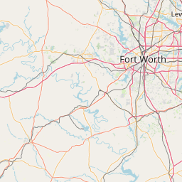
Exact coordinates of the repeater are not known.
Coverage circle based on mobile coverage and ignores propagation anomalies and terrain.

Signal Reports (click map icon for details): Base Mobile HT
Add a Signal Report


Date Information Updated
2021-01-29 16:28:31 Added.

Call Date Details
2024-10-22 Recent activity detected from BrandMeister.


Visit our DMR pages | Learn more about DMR | NetWatch

- DMR Talk groups are updated directly on radioid.net or BrandMeister.network.
- The IPSC Network is obtained from the radioid.net API. If this information is not correct, please update it at radioid.net.
- Did you know that Repeaterbook has its own BrandMeister talk group? Find us at 31419 (BrandMeister only).