Plaza - W0WJB
Kansas City, MO
Repeater ID: 29-16915
| Downlink: | 443.17500 |
| Uplink: | 448.17500 |
| Offset: | +5.000 MHz |
| Uplink Tone: | 151.4 |
| County: | Jackson |
| Grid: | EM29rc |
| Call: | W0WJB |
| Use: | OPEN |
| Op Status: | |
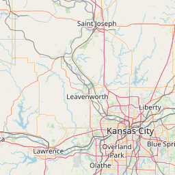
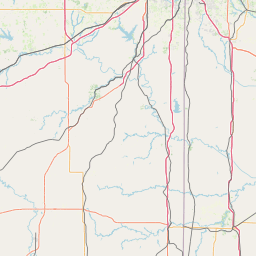
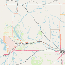
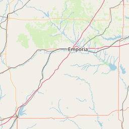
| Coverage: |
50 mi radius. |
| Sponsor: | W0WJB |
| Features: | Emergency power equipped. |
| FM: | Yes; analog capable: 25.0 kHz (wideband) |
| Last updated: 2020-08-06 | |
| Last reviewed:
2020-08-06 |
|


Exact coordinates of the repeater are
known.
Coverage circle based on mobile coverage and ignores propagation anomalies and terrain.