(1 of 2) ...The Flood Warning continues for the following rivers in North Carolina... Green Mill Run At Green Mill Run in Greenville affecting Pitt County. * WHAT...Moderate flooding is occurring. * WHERE...Green Mill Run at Green Mill Run in Greenville. * WHEN...Until further notice. * IMPACTS...At 10.0 feet, Any travel in the vicinity of the stream on the southeast side of Greenville is likely impossible as at least several feet of water inundates roads near crossings. Numerous homes and businesses adjacent to the stream are likely surrounded by water, with some structures inundated by a few feet of water. Swift flowing water across the roadway is likely just east of the intersection of 14th street and Charles Boulevard. * ADDITIONAL DETAILS... - At 10:25 AM EDT Monday the stage was 9.5 feet. - Forecast...No forecast is available for this location. - Flood stage is 7.5 feet. - http://www.weather.gov/safety/flood (2 of 2) ...The National Weather Service in Newport/Morehead City NC has issued a Flood Warning for the following rivers in North Carolina... Tar River At Greenville affecting Pitt County. For the Tar River...including Greenville...Minor flooding is forecast. * WHAT...Minor flooding is forecast. * WHERE...Tar River at Greenville. * WHEN...From late tonight to Saturday morning. * IMPACTS...At 16.0 feet, Widespread low land flooding adjacent to the river. Some farmland flooded across Pitt County. * ADDITIONAL DETAILS... - At 9:00 AM EDT Monday the stage was 9.3 feet. - Forecast...The river is expected to rise above flood stage late tonight to a crest of 15.5 feet early Wednesday morning. It will then fall below flood stage early Saturday morning. - Flood stage is 13.0 feet. - http://www.weather.gov/safety/flood
honey pot Rocky Mount, WDWG 98.5 tower, North Carolina, 147.12, WB4YNF Repeater

WDWG 98.5 tower - WB4YNF

Rocky Mount, NC
Repeater ID: 37-187

Downlink: 147.12000
Uplink: 147.72000
Offset: +0.600 MHz
Uplink Tone: 131.8
Downlink Tone: 131.8
County: Edgecombe
Grid: FM15bv
Call: WB4YNF
Use: OPEN
Op Status: OFF-AIR Off-Air
Coverage:
Sponsor: WB4YNF
FM: Yes; analog capable: 25.0 kHz (wideband)
Last updated: 2023-09-07
Last reviewed: 2025-05-18
MarkerMarker
30 km
30 mi
Leaflet © OSM contributors

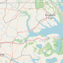
Exact coordinates of the repeater are known.
Coverage circle based on mobile coverage and ignores propagation anomalies and terrain.

Signal Reports (click map icon for details): Base Mobile HT
Add a Signal Report


Date Information Updated
2021-01-29 16:27:15 I-87 coverage deleted.
2021-01-29 16:26:42 NC-87 coverage added.
2021-01-29 16:26:42 I-87 coverage added.
2021-01-29 16:26:42 I-95 coverage added.
2021-01-29 16:26:42 I-87 coverage added.
2021-01-29 16:26:42 US-64 coverage added.
2021-01-29 16:26:42 US-264 coverage added.
2021-01-29 16:26:42 US-301 coverage added.

Call Date Details
K9SPJ (registered) 2025-05-17 Updated callsign
WG3K (registered) 2024-01-30 Reported no changes
K9SPJ (registered) 2023-08-30 Marked as off-air.