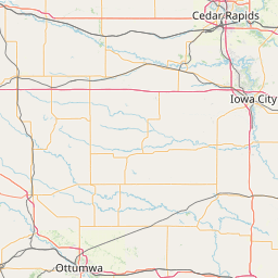
Charter Oak, IA
KI0HC
Repeater ID: 19-20820

| Downlink: | 442.10000 |
| Uplink: | 447.10000 |
| Offset: | +5.000 MHz |
| P-25 Digital Enabled | |
| NAC: | 293 |
| Default Reflector: | |
| County: | Crawford |
| Call: | KI0HC |
| Use: | OPEN |
| Op Status: | |
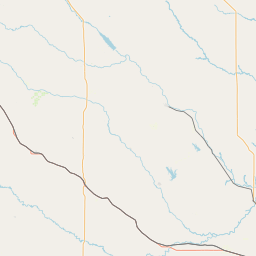
| Coverage: |
Estimated Area Coverage: Charter Oak, IA; Crawford, IA; Monona County, IA area. 15 mi radius. |
| Pattern: | Omnidirectional |
| Features: |
This is a linked system to the 900 P25 Network System in Colorado. The network has 6 voted P25 Quantar repeaters that covers 90% of the front range on I-25 from Wyoming to New Mexico. |
| Notes: | IaRC Listing (as of 15 June 2023): This repeater does not appear in the IaRC online database. RB: Current Repeater Record Custodian (RRC) for KI0HC 442.10000 Charter Oak repeater (19-20820): KI0HC. Per Trustee: "Tried to get a proper coordination from Iowa, but 3 months later I received an email from them with conflict in Nebraska City 100 mile away, they said I need 125 miles for my back yard repeater!" |
| Last updated: 2023-06-15 | |
| Last reviewed: 2023-06-18 | |
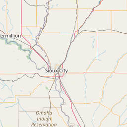
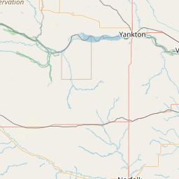


Exact coordinates of the repeater are
not known.
Coverage circle based on mobile coverage and ignores propagation anomalies and terrain.