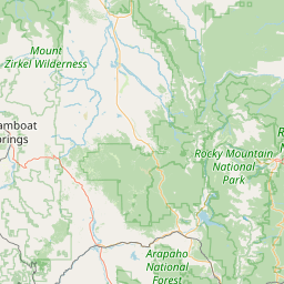
(1 of 11) SVRBOU The National Weather Service in Denver Colorado has issued a * Severe Thunderstorm Warning for... Southeastern Washington County in northeastern Colorado... * Until 830 PM MDT. * At 806 PM MDT, a severe thunderstorm was located 10 miles north of Arickaree School, or 20 miles southwest of Yuma, moving east at 20 mph. HAZARD...70 mph wind gusts. SOURCE...Radar indicated. IMPACT...Expect considerable tree damage. Damage is likely to mobile homes, roofs, and outbuildings. * Locations impacted include... Arickaree School and Cope. (2 of 11) SVRBOU The National Weather Service in Denver Colorado has issued a * Severe Thunderstorm Warning for... East central Washington County in northeastern Colorado... * Until 830 PM MDT. * At 753 PM MDT, a severe thunderstorm was located near Akron, moving east at 40 mph. HAZARD...60 mph wind gusts. SOURCE...Radar indicated. IMPACT...Expect damage to roofs, siding, and trees. * Locations impacted include... Akron, Otis, and Platner. (3 of 11) SVRBOU The National Weather Service in Denver Colorado has issued a * Severe Thunderstorm Warning for... East central Washington County in northeastern Colorado... * Until 815 PM MDT. * At 742 PM MDT, a severe thunderstorm was located near Elba, or 17 miles south of Akron, moving east at 50 mph. HAZARD...60 mph wind gusts. SOURCE...Radar indicated. IMPACT...Expect damage to roofs, siding, and trees. * Locations impacted include... Elba. (4 of 11) ...The Flood Warning continues for the following rivers in Colorado... Arkansas River At Canon City affecting Fremont County. Arkansas River At La Junta affecting Otero County. Arkansas River NEAR Avondale affecting Pueblo County. .Warm temperatures will melt high mountain snowpack and increase river flows. For the Lower Arkansas River...including Avondale and La Junta, Minor flooding is forecast. * WHAT...Minor flooding is occurring and minor flooding is forecast. * WHERE...Arkansas River near Avondale. * WHEN...Until further notice. * IMPACTS...At 7.0 feet, Minor lowland flooding occurs near Avondale. * ADDITIONAL DETAILS... - At 7:00 PM MDT Saturday the stage was 7.4 feet. - Bankfull stage is 5.0 feet. - Recent Activity...The maximum river stage in the 24 hours ending at 7:00 PM MDT Saturday was 7.5 feet. - Forecast...The river is expected to remain steady above flood stage at 7.4 feet. - Flood stage is 7.0 feet. - Flood History...This crest compares to a previous crest of 7.8 feet on 04/24/1942. - http://www.weather.gov/safety/flood (5 of 11) ...The Flood Warning continues for the following rivers in Colorado... Arkansas River At Canon City affecting Fremont County. Arkansas River At La Junta affecting Otero County. Arkansas River NEAR Avondale affecting Pueblo County. .Warm temperatures will melt high mountain snowpack and increase river flows. For the Lower Arkansas River...including Avondale and La Junta, Minor flooding is forecast. * WHAT...No flooding is currently forecast. * WHERE...Arkansas River at La Junta. * WHEN...Until further notice. * IMPACTS...At 11.0 feet, Minor Flood. Minor agricultural flooding. * ADDITIONAL DETAILS... - At 6:15 PM MDT Saturday the stage was 10.8 feet. - Bankfull stage is 10.0 feet. - Forecast...The river is expected to fall to 10.3 feet Thursday evening. - Flood stage is 11.0 feet. - Flood History...This crest compares to a previous crest of 10.9 feet on 06/04/1994. - http://www.weather.gov/safety/flood (6 of 11) ...The Flood Warning continues for the following rivers in Colorado... Arkansas River At Canon City affecting Fremont County. Arkansas River At La Junta affecting Otero County. Arkansas River NEAR Avondale affecting Pueblo County. .Warm temperatures will melt high mountain snowpack and increase river flows. For the Lower Arkansas River...including Avondale and La Junta, Minor flooding is forecast. * WHAT...No flooding is currently forecast. * WHERE...Arkansas River at Canon City. * WHEN...Until further notice. * IMPACTS...At 10.0 feet, Minor flood. Minor overbank flow occurs into low lying areas along river. Water overtops screens at Canon City water supply intake * ADDITIONAL DETAILS... - At 6:15 PM MDT Saturday the stage was 9.4 feet. - Bankfull stage is 8.0 feet. - Forecast...The river is expected to rise to a crest of 9.4 feet just after midnight tonight. - Flood stage is 10.0 feet. - Flood History...This crest compares to a previous crest of 9.4 feet on 06/10/1987. - http://www.weather.gov/safety/flood (7 of 11) The National Weather Service in Denver has issued a Red Flag Warning for wind and low relative humidity, which is in effect from noon to 6 PM MDT Sunday. * Affected Area...Fire Weather Zones 213, 214, 241, 245, 246 and 247. * Timing...From 12 PM until 6 PM MDT Sunday afternoon. * Winds...South 10 to 20 mph with gusts up to 30 mph. * Relative Humidity...As low as 10 percent. * Impacts...Conditions will be favorable for rapid fire spread. Avoid outdoor burning and any activity that may produce a spark and start a wildfire. (8 of 11) ...FIRE WEATHER WATCH IN EFFECT FROM MONDAY AFTERNOON THROUGH MONDAY EVENING FOR FIRE WEATHER ZONES 224 AND 233... The National Weather Service in Pueblo has issued a Red Flag Warning for gusty winds and low relative humidity, which is in effect from noon to 8 PM MDT Sunday. A Fire Weather Watch has also been issued. This Fire Weather Watch for gusty winds and low relative humidity is in effect from Monday afternoon through Monday evening. * Affected Area...Fire Weather Zones 224 and 233. * Winds...Southwest 15 to 25 mph with gusts up to 40 mph. * Relative Humidity...As low as 7 percent. * Impacts...Conditions will be favorable for rapid rates of fire growth and spread. (9 of 11) The National Weather Service in Pueblo has issued a Red Flag Warning for gusty winds and low relative humidity, which is in effect from noon to 8 PM MDT Sunday. * Affected Area...Fire Weather Zone 237. * Winds...South 15 to 25 mph with gusts up to 40 mph. * Relative Humidity...As low as 11 percent. * Impacts...Conditions will be favorable for rapid rates of fire growth and spread. (10 of 11) ...RED FLAG WARNING REMAINS IN EFFECT FROM 11 AM TO 10 PM MDT MONDAY FOR GUSTY WINDS, LOW RELATIVE HUMIDITY AND DRY FUELS FOR FIRE WEATHER ZONES 203, 207, 290, 291, 292, 293, 490, AND 491... * AFFECTED AREA...In Colorado, Fire Weather Zone 203 Lower Colorado River, Fire Weather Zone 207 Southwest Colorado Lower Forecast Area, Fire Weather Zone 290 Paradox Valley Forecast Area, Fire Weather Zone 291 Northern San Juan Forecast Area, Fire Weather Zone 292 North Fork Forecast Area and Fire Weather Zone 293 Gunnison Basin Forecast Area. In Utah, Fire Weather Zone 490 Colorado River Basin and Fire Weather Zone 491 Southeast Utah. * WINDS...Southwest 15 to 25 mph with gusts up to 45 mph. * RELATIVE HUMIDITY...6 to 11 percent. * IMPACTS...Conditions may become favorable for the easy ignition and rapid spread of fires due to low relative humidity and strong gusty winds. (11 of 11) ...RED FLAG WARNING REMAINS IN EFFECT FROM 11 AM TO 10 PM MDT MONDAY FOR GUSTY WINDS, LOW RELATIVE HUMIDITY AND DRY FUELS FOR FIRE WEATHER ZONES 203, 207, 290, 291, 292, 293, 490, AND 491... * AFFECTED AREA...In Colorado, Fire Weather Zone 203 Lower Colorado River, Fire Weather Zone 207 Southwest Colorado Lower Forecast Area, Fire Weather Zone 290 Paradox Valley Forecast Area, Fire Weather Zone 291 Northern San Juan Forecast Area, Fire Weather Zone 292 North Fork Forecast Area and Fire Weather Zone 293 Gunnison Basin Forecast Area. In Utah, Fire Weather Zone 490 Colorado River Basin and Fire Weather Zone 491 Southeast Utah. * WINDS...Southwest 15 to 25 mph with gusts up to 45 mph. * RELATIVE HUMIDITY...6 to 11 percent. * IMPACTS...Conditions may become favorable for the easy ignition and rapid spread of fires due to low relative humidity and strong gusty winds.
RepeaterBook.com Home Page
Advertisements


honey pot Silverthorne, Colorado, 446.9625, KG0RP Repeater

Silverthorne, CO

KG0RP
Repeater ID: 08-21094

Repeaterbook.com registered user


Downlink: 446.96250
Uplink: 441.96250
Offset: -5.0 MHz
DMR Enabled
Color Code: 11
DMR ID: 313150
IPSC Network: BM - Color Code: 11 - TS Linked: TS1 TS2 - Trustee: radio id dot net antenna logo KG0RP
Time Slot # 2 - 93 = North America
Time Slot # 1 - 98977 = OpenGD77
Time Slot # 1 - 313150 = LOCAL
Open DMR repeater., Dynamic TGs on TS1. TG93 static on TS2. Covers Summit County. (Silverthorne,Keystone/Brekaenridge,Dillon.Frisco) Colorado
Both Slots Linked
*Information courtesy of radioid.net and the BrandMeister Network. Repeater trustees can directly update this data through their respective websites.
IPSC: BrandMeister US
County: Summit
Call: KG0RP
Use: OPEN
Op Status: ON-AIR On-Air
Coverage: Covers Summit county
20 mi radius.
Sponsor: KG0RP
Features: TG93 on TS2, All BM TGs on TS1, Mountain/Front Range TG313150 on TS1, TGIF on TS1 4+6digit TG (4TTTTTT) DMR+ on TS1 8+4digit TG (8DDDD) send TG4000 to unlink. Please unlink when done listening. No timeout on TGIF or DMR+
Coordination: CCARC

Open Street Map

Coordinates of the repeater are not known and have been estimated.

Add a Propagation Report

- Base - HT - Mobile
Click the icons on map for details.


Call Date Details
VE2WKR (registered) 2023-12-23 Features changed.
VE2WKR (registered) 2022-08-09 CC, Repeater ID, CCARC Coordinated
VE2WKR (registered) 2022-07-25 Added.


Visit our DMR pages | Learn more about DMR | NetWatch

- DMR Talk groups are updated directly on radioid.net or BrandMeister.network.
- The IPSC Network is obtained from the radioid.net API. If this information is not correct, please update it at radioid.net.
- Did you know that Repeaterbook has its own BrandMeister talk group? Find us at 31419 (BrandMeister only).

   
If you have an iPhone/iPod/iPad or Android device, please download the FREE official RepeaterBook app!


Advertisement

Copyright © 2006-2024 RepeaterBook.com. All Rights Reserved.
Created and owned by KD6KPC/WREQ745 since 2006.
All data, including non-copyrightable data, is protected from theft under Oregon law (ORS 164.377).

Page created in 2.832886 seconds.