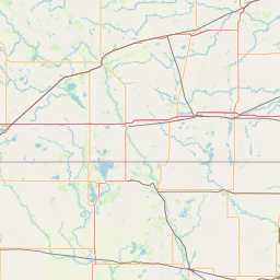
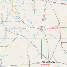
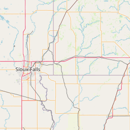
(1 of 3) FFWMPX The National Weather Service in the Twin Cities has issued a * Flash Flood Warning for... Southern McLeod County in central Minnesota... Southeastern Renville County in central Minnesota... Northwestern Sibley County in central Minnesota... * Until 645 AM CDT Sunday. * At 1242 AM CDT, Doppler radar indicated thunderstorms producing heavy rain across the warned area. Between 2 and 3.5 inches of rain have fallen. The expected rainfall rate is 2 to 3 inches in 1 hour. Flash flooding is ongoing or expected to begin shortly. HAZARD...Flash flooding caused by thunderstorms. SOURCE...Radar. IMPACT...Flash flooding of small creeks and streams, urban areas, highways, streets and underpasses as well as other poor drainage and low-lying areas. (2 of 3) ...The Flood Warning is extended for the following rivers in Minnesota... Minnesota River at Morton affecting Renville and Redwood Counties. Minnesota River at Montevideo affecting Chippewa, Lac qui Parle and Yellow Medicine Counties. .Recent and future rainfall continues to impact river levels on the Minnesota River at Montevideo and Morton. Rain and thunderstorms remain likely overnight, with another storm system set to bring widespread rain and thunderstorms to the region Sunday night and Monday. River levels will remain steady or rise further as a result. * WHAT...Minor flooding is occurring and minor flooding is forecast. * WHERE...Minnesota River at Montevideo. * WHEN...Until further notice. * IMPACTS...At 14.0 feet, Low lying areas and some roads along the river begin flooding, along with some basements of houses along the river. * ADDITIONAL DETAILS... - At 800 PM CDT Saturday, the stage was 14.2 feet. - Recent Activity...The maximum river stage in the 24 hours ending at 800 PM CDT Saturday was 14.3 feet. - Forecast...The river is expected to fall below flood stage tomorrow evening and continue falling to 12.5 feet Saturday, June 22. - Flood stage is 14.0 feet. - Flood History...This crest compares to a previous crest of 14.2 feet on 06/25/1991. (3 of 3) ...The Flood Warning is extended for the following rivers in Minnesota... Minnesota River at Morton affecting Renville and Redwood Counties. Minnesota River at Montevideo affecting Chippewa, Lac qui Parle and Yellow Medicine Counties. .Recent and future rainfall continues to impact river levels on the Minnesota River at Montevideo and Morton. Rain and thunderstorms remain likely overnight, with another storm system set to bring widespread rain and thunderstorms to the region Sunday night and Monday. River levels will remain steady or rise further as a result. * WHAT...Minor flooding is occurring and minor flooding is forecast. * WHERE...Minnesota River at Morton. * WHEN...Until further notice. * IMPACTS...At 23.0 feet, Riverside Rd and Front Street flooded in North Redwood. * ADDITIONAL DETAILS... - At 800 PM CDT Saturday, the stage was 21.1 feet. - Recent Activity...The maximum river stage in the 24 hours ending at 800 PM CDT Saturday was 21.1 feet. - Forecast...The river is expected to fall below flood stage tomorrow morning and continue falling to 18.8 feet Saturday, June 22. - Flood stage is 21.0 feet. - Flood History...This crest compares to a previous crest of 21.4 feet on 05/31/2004.
RepeaterBook.com Home Page
Advertisements


honey pot Fairmont, Minnesota, 443.925, K6ZC Repeater

Fairmont, MN

K6ZC
Repeater ID: 27-211

Downlink: 443.92500
Uplink: 448.92500
Offset: +5.000 MHz
D-STAR Enabled
Node: K6ZC (B) Gateway Repeater
Sources: jfindu lookup / dstar-users lookup
County: Martin
Grid: EN23MA
Call: K6ZC
Use: OPEN
Op Status: ON-AIR On-Air
Coverage: 
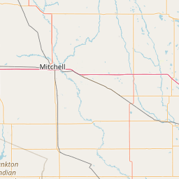
Coverage along I-90 extends from just east of Sherburn (about mile marker 91) to Guckeen (about mile marker 113).
Sponsor: CMARS
Coordination: Minnesota Repeater Council

Open Street Map

Exact coordinates of the repeater are known.
Coverage circle does not account for propagation anomalies or terrain.

Add a Propagation Report

- Base - HT - Mobile
Click the icons on map for details.


Call Date Information
KD0UXO 2016-02-10 status change off air


If you have an iPhone/iPod/iPad or Android device, please download the FREE official RepeaterBook app!


Advertisement

Copyright © 2006-2024 RepeaterBook.com. All Rights Reserved.
Created and owned by KD6KPC/WREQ745 since 2006.
All data, including non-copyrightable data, is protected from theft under Oregon law (ORS 164.377).

Page created in 0.040487 seconds.