(1 of 6) ...The Flood Warning is extended for the following rivers in Texas... Neches River Near Alto affecting Cherokee, Trinity, Anderson and Houston Counties. ...The Flood Warning continues for the following rivers in Texas... Neches River Near Neches affecting Cherokee, Anderson and Houston Counties. Neches River Near Diboll affecting Angelina, Houston, Trinity, Polk and Tyler Counties. For the Neches River...including Neches, Alto, Diboll...Minor flooding is forecast. * WHAT...Minor flooding is occurring and minor flooding is forecast. * WHERE...Neches River near Neches. * WHEN...Until Tuesday evening. * IMPACTS...At 12.0 feet, Expect minor lowland flooding of the heavily wooded floodplain. Ranchers that may have livestock and equipment in the river bottoms should move them to higher ground. Expect minor flooding of the boat ramp. * ADDITIONAL DETAILS... - At 7:30 AM CDT Monday the stage was 12.4 feet. - Bankfull stage is 12.0 feet. - Recent Activity...The maximum river stage in the 24 hours ending at 7:30 AM CDT Monday was 12.7 feet. - Forecast...The river is expected to fall below flood stage late tonight and continue falling to 9.7 feet Saturday morning. - Flood stage is 12.0 feet. - http://www.weather.gov/safety/flood (2 of 6) ...The Flood Warning is extended for the following rivers in Texas... Neches River Near Alto affecting Cherokee, Trinity, Anderson and Houston Counties. ...The Flood Warning continues for the following rivers in Texas... Neches River Near Neches affecting Cherokee, Anderson and Houston Counties. Neches River Near Diboll affecting Angelina, Houston, Trinity, Polk and Tyler Counties. For the Neches River...including Neches, Alto, Diboll...Minor flooding is forecast. * WHAT...Minor flooding is occurring and minor flooding is forecast. * WHERE...Neches River near Alto. * WHEN...Until Wednesday morning. * IMPACTS...At 16.0 feet, Boat ramps and picnic areas near the river will begin to flood. Ranchers should move cattle and equipment near the river to higher ground. * ADDITIONAL DETAILS... - At 7:15 AM CDT Monday the stage was 16.3 feet. - Bankfull stage is 16.0 feet. - Recent Activity...The maximum river stage in the 24 hours ending at 7:15 AM CDT Monday was 16.6 feet. - Forecast...The river is expected to fall below flood stage late this evening and continue falling to 13.5 feet Saturday morning. - Flood stage is 16.0 feet. - http://www.weather.gov/safety/flood (3 of 6) ...The Flood Warning is extended for the following rivers in Texas... Neches River Near Alto affecting Cherokee, Trinity, Anderson and Houston Counties. ...The Flood Warning continues for the following rivers in Texas... Neches River Near Neches affecting Cherokee, Anderson and Houston Counties. Neches River Near Diboll affecting Angelina, Houston, Trinity, Polk and Tyler Counties. For the Neches River...including Neches, Alto, Diboll...Minor flooding is forecast. * WHAT...Minor flooding is occurring and minor flooding is forecast. * WHERE...Neches River near Diboll. * WHEN...Until further notice. * IMPACTS...At 14.0 feet, Minor lowland flooding of boat ramps, paths, and trails. Move livestock and equipment to higher ground. * ADDITIONAL DETAILS... - At 7:15 AM CDT Monday the stage was 13.3 feet. - Bankfull stage is 12.0 feet. - Recent Activity...The maximum river stage in the 24 hours ending at 7:15 AM CDT Monday was 13.4 feet. - Forecast...The river is expected to fall to 12.2 feet Saturday morning. - Flood stage is 12.0 feet. - http://www.weather.gov/safety/flood (4 of 6) ...The Flood Warning continues for the following rivers in Texas... Angelina River Near Lufkin affecting Nacogdoches and Angelina Counties. For the Angelina River...including Lufkin...Minor flooding is forecast. * WHAT...Minor flooding is occurring and minor flooding is forecast. * WHERE...Angelina River near Lufkin. * WHEN...Until Sunday afternoon. * IMPACTS...At 162.0 feet, Minor lowland to diminish and end on the lower Angelina River. * ADDITIONAL DETAILS... - At 8:00 AM CDT Monday the stage was 163.1 feet. - Bankfull stage is 158.5 feet. - Recent Activity...The maximum river stage in the 24 hours ending at 8:00 AM CDT Monday was 163.5 feet. - Forecast...The river is expected to fall below flood stage early Saturday morning and continue falling to 160.9 feet Saturday morning. - Flood stage is 161.0 feet. - http://www.weather.gov/safety/flood (5 of 6) ...The Flood Warning continues for the following rivers in Texas... Denton Creek Near Justin affecting Denton County. * WHAT...Minor flooding is occurring and minor flooding is forecast. * WHERE...Denton Creek near Justin. * WHEN...Until late this evening. * ADDITIONAL DETAILS... - At 8:00 AM CDT Monday the stage was 12.5 feet. - Bankfull stage is 10.0 feet. - Flood stage is 10.0 feet. - Forecast...The river is expected to fall below flood stage late this morning and continue falling to 3.6 feet Saturday morning. (6 of 6) ...The National Weather Service in Fort Worth TX has issued a Flood Warning for the following rivers in Texas... West Fork Trinity River Near Boyd affecting Wise County. * WHAT...Minor flooding is forecast. * WHERE...West Fork Trinity River near Boyd. * WHEN...Until early tomorrow afternoon. * IMPACTS...At 16.0 feet, Minor overbank flooding is expected. Farm and ranch land adjacent to the river will flood, and a few rural roads may be affected. * ADDITIONAL DETAILS... - At 7:15 AM CDT Monday the stage was 15.4 feet. - Bankfull stage is 16.0 feet. - Flood stage is 16.0 feet. - Forecast...The river is expected to rise above flood stage late this morning to a crest of 16.4 feet this afternoon. It will then fall below flood stage just after midnight tonight.
RepeaterBook.com Home Page
honey pot Burleson, Texas, 145.53, KC5CPO Simplex Node

Burleson, TX

KC5CPO
Repeater ID: 48-22863 | Local ID: 0

Downlink: 145.53000
Offset: Simplex
Bandwidth: 25.0 kHz
System Fusion Enabled
DG-ID: 00 - Open
WIRES-X: 98735 KC5CPO-PDN is currently active.
Reflector: None found
County: Johnson
Call: KC5CPO
Use: OPEN
Op Status: ON-AIR On-Air
Coverage: 12 mi radius.
Affiliate: Murphy Radio Network (MRN)
Links:
System Links:
Full-time to the Murphy Radio Network System.
Web links: Murphy Radio Network System
50 km
30 mi
Leaflet | © OpenStreetMap, © OpenStreetMap contributors

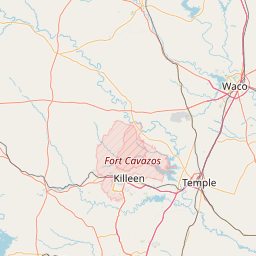
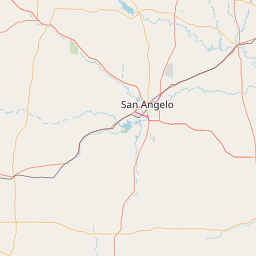
Exact coordinates of the node are known.
Coverage circle does not account for propagation anomalies or terrain.

Add a Propagation Report

- Base - HT - Mobile
Click the icons on map for details.


Call Date Details
2024-10-07 Added.


Visit our WIRES pages | Learn more about WIRES-X