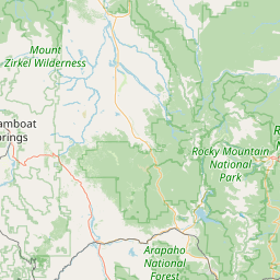
Estes Park, CO
N0FH
Repeater ID: 08-119
| Downlink: | 146.68500 |
| Uplink: | 146.08500 |
| Offset: | -0.600 MHz |
| Uplink Tone: | 123.0 |
| Downlink Tone: | 123.0 |
| County: | Larimer |
| Grid: | DN70gi |
| Call: | N0FH |
| Use: | OPEN |
| Op Status: | |
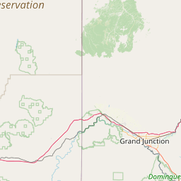
| Coverage: |
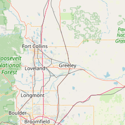
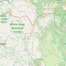
Estes Valley and east RMNP - some coverage E and SE (Loveland and Denver) |
| Sponsor: | Estes Valley ARC |
| Features: | Emergency power equipped. |
| FM: | Yes; analog capable: 25.0 kHz (wideband) |
| Links: |
Full-time to 449.80000 (N0FH) at Estes Park, CO. |
| EchoLink: | 625757 N0FH-R |
| 👍 ON - IDLE | |
| IRLP: |
7268
Extended Down for 949 days, 13 hours, 7 minutes, 56 seconds. |
| Commands: | The EchoLink node connects to both machines. The node is open (no passwords; touch tone only the the * character followed by a four, five, or six digit node number where you wish to connect). The disconnect is #. |
| Notes: | Both Echolink and IRLP are open, IRLP connect is a four digit node number only and '73' to disconnect. Top of Hour time is announced from 0600 to 2200. |
| Nets: | ARES D-10: Thu at 19:00. |
| Coordination: | CCARC |
| Last updated: 2022-06-20 | |
| Last reviewed: 2024-09-13 | |


Exact coordinates of the repeater are
known.
Coverage circle based on mobile coverage and ignores propagation anomalies and terrain.
Good one to have in the HT if you are hiking the national park or nearby stuff. Only repeater coverage in the Estes valley area.
(member) on 2022-06-20.I was able to hit this repeater from the YMCA Camp of the Rockies with a HT and Signal Stick antenna, but didn't get any response even when calling for a signal check a couple times during the day on a Saturday.
(member) on 2024-05-27.Negative contact all over the Estes area, is the repeater down?
Activity
Travel
Posted by: K5BBC
Activity
Travel
Posted by: AE0QH
Activity
Travel
Posted by: KC0USQ