(1 of 7) ...The Flood Warning continues for the following rivers in Arkansas... Fourche Lafave River Near Houston affecting Perry County. For the Fourche Lafave River...including Houston, Gravelly...Minor flooding is forecast. * WHAT...Minor flooding is forecast. * WHERE...Fourche Lafave River near Houston. * WHEN...From Saturday morning to Thursday afternoon. * IMPACTS...At 25.0 feet, Agricultural lands along the Arkansas River and up into the Fourche LaFave begin to flood. Equipment and livestock should be moved to higher ground. * ADDITIONAL DETAILS... - At 7:30 PM CDT Friday the stage was 24.5 feet. - Forecast...The river is expected to rise above flood stage tomorrow morning to a crest of 25.5 feet early Sunday afternoon. It will then fall below flood stage late Wednesday morning. - Flood stage is 25.0 feet. - http://www.weather.gov/safety/flood (2 of 7) ...The Flood Warning is extended for the following rivers in Arkansas... Black River At Black Rock affecting Jackson, Lawrence and Independence Counties. For the Black River...including Corning, Pocahontas, Black Rock... Minor flooding is forecast. * WHAT...Minor flooding is occurring and minor flooding is forecast. * WHERE...Black River at Black Rock. * WHEN...Until early Monday morning. * IMPACTS...At 14.0 feet, Minor flooding begins. Farm ground along east bank begins to flood. * ADDITIONAL DETAILS... - At 7:00 PM CDT Friday the stage was 14.8 feet. - Forecast...The river is expected to fall below flood stage late tomorrow evening and continue falling to 11.2 feet Wednesday evening. - Flood stage is 14.0 feet. - http://www.weather.gov/safety/flood (3 of 7) ...The Flood Warning continues for the following rivers in Arkansas... White River At Georgetown affecting Woodruff, Prairie and White Counties. White River At Des Arc affecting Prairie County. White River At Clarendon affecting Monroe and Arkansas Counties. White River At Augusta affecting Woodruff and White Counties. For the Lower White River...including Newport, Augusta, Georgetown, Des Arc, Clarendon...Minor flooding is forecast. * WHAT...Minor flooding is forecast. * WHERE...White River at Georgetown. * WHEN...Until early Wednesday afternoon. * IMPACTS...At 21.0 feet, Hurricane Lake Wildlife Management Area and Raft Creek Bottoms inundated. Roads in the bottoms are flooded. * ADDITIONAL DETAILS... - At 7:00 PM CDT Friday the stage was 21.0 feet. - Forecast...The river is expected to rise above flood stage just after midnight tonight to a crest of 21.1 feet tomorrow evening. It will then fall below flood stage Tuesday morning. - Flood stage is 21.0 feet. - http://www.weather.gov/safety/flood (4 of 7) ...The Flood Warning continues for the following rivers in Arkansas... White River At Georgetown affecting Woodruff, Prairie and White Counties. White River At Des Arc affecting Prairie County. White River At Clarendon affecting Monroe and Arkansas Counties. White River At Augusta affecting Woodruff and White Counties. For the Lower White River...including Newport, Augusta, Georgetown, Des Arc, Clarendon...Minor flooding is forecast. * WHAT...Minor flooding is occurring and minor flooding is forecast. * WHERE...White River at Des Arc. * WHEN...Until further notice. * IMPACTS...At 24.0 feet, Many acres of farmland flooded within the levees. Water is backing up Bayou Des Arc and Cypress Bayou. * ADDITIONAL DETAILS... - At 7:00 PM CDT Friday the stage was 25.1 feet. - Forecast...The river is expected to rise to a crest of 25.2 feet just after midnight tonight. - Flood stage is 24.0 feet. - http://www.weather.gov/safety/flood (5 of 7) ...The Flood Warning continues for the following rivers in Arkansas... White River At Georgetown affecting Woodruff, Prairie and White Counties. White River At Des Arc affecting Prairie County. White River At Clarendon affecting Monroe and Arkansas Counties. White River At Augusta affecting Woodruff and White Counties. For the Lower White River...including Newport, Augusta, Georgetown, Des Arc, Clarendon...Minor flooding is forecast. * WHAT...Minor flooding is occurring and minor flooding is forecast. * WHERE...White River at Clarendon. * WHEN...Until further notice. * IMPACTS...At 28.0 feet, Flooding of cropland and timber is occurring. Roads to homes and cabins in lower Maddox Bay area off Highway 146 south of Clarendon impassible. * ADDITIONAL DETAILS... - At 7:00 PM CDT Friday the stage was 28.3 feet. - Forecast...The river is expected to remain steady above flood stage at 28.2 feet. - Flood stage is 26.0 feet. - http://www.weather.gov/safety/flood (6 of 7) ...The Flood Warning continues for the following rivers in Arkansas... White River At Georgetown affecting Woodruff, Prairie and White Counties. White River At Des Arc affecting Prairie County. White River At Clarendon affecting Monroe and Arkansas Counties. White River At Augusta affecting Woodruff and White Counties. For the Lower White River...including Newport, Augusta, Georgetown, Des Arc, Clarendon...Minor flooding is forecast. * WHAT...Minor flooding is occurring and minor flooding is forecast. * WHERE...White River at Augusta. * WHEN...Until further notice. * IMPACTS...At 32.0 feet, Thousands of acres of cropland and farm roads are flooded in White and Woodruff counties. Water is isolating homes and camps along the river in White and Woodruff counties. * ADDITIONAL DETAILS... - At 7:00 PM CDT Friday the stage was 31.1 feet. - Forecast...The river is expected to rise to a crest of 31.1 feet just after midnight tonight. - Flood stage is 26.0 feet. - http://www.weather.gov/safety/flood (7 of 7) ...The Flood Warning continues for the following rivers in Louisiana...Arkansas... Bayou Dorcheat Near Springhill affecting Columbia and Webster Parishes. For the Bayou Dorcheat...including Springhill, Dixie Inn, Lake Bistineau...Moderate flooding is forecast. * WHAT...Minor flooding is occurring and minor flooding is forecast. * WHERE...Bayou Dorcheat near Springhill. * WHEN...Until further notice. * IMPACTS...At 13.0 feet, Minor lowland flooding of private boat ramps. Move livestock to higher ground. * ADDITIONAL DETAILS... - At 7:00 PM CDT Friday the stage was 14.3 feet. - Bankfull stage is 11.0 feet. - Recent Activity...The maximum river stage in the 24 hours ending at 7:00 PM CDT Friday was 15.3 feet. - Forecast...The river is expected to fall to 13.1 feet Wednesday evening. - Flood stage is 11.0 feet. - http://www.weather.gov/safety/flood
honey pot Springdale, Dodd Mtn, Arkansas, 442.525, KG5JPJ Repeater

Dodd Mtn - KG5JPJ

Springdale, AR
Repeater ID: 05-13820

Downlink: 442.52500
Uplink: 447.52500
Offset: +5.000 MHz
D-STAR Enabled
Node: KG5JPJ (B) Repeater
DMR Enabled
Color Code: 1
DMR ID: radio id dot net antenna logo 314359
IPSC Network: BM - Color Code: 1 - TS Linked: TS1 TS2 - Trustee: radio id dot net antenna logo N5KWL


Information courtesy of radioid.net. Repeater trustees can directly update this data through their website.
County: Washington
Grid: EM26we
Call: KG5JPJ
Use: OPEN
Op Status: ON-AIR On-Air
Coverage: 40 mi radius.
Sponsor: N5KWL
Affiliate: NWA Link System Affiliate
Notes: Connected to REF077A
Web links: jfindu
dstarusers.org
APRS.fi
Coordination: ARC
ARC ID: 495
Last updated: 2024-09-04
Last reviewed: 2024-09-04
MarkerMarker
30 km
30 mi
Leaflet © OSM contributors

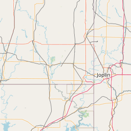
Exact coordinates of the repeater are known.
Coverage circle based on mobile coverage and ignores propagation anomalies and terrain.

Signal Reports (click map icon for details): Base Mobile HT
Add a Signal Report


Date Information Updated
2021-01-29 16:28:31 Added.
2020-05-28 00:00:00 Added webpage
2020-04-24 00:00:00 County changed from Bemton to Washington.
2020-04-20 00:00:00 Changed nearest city from Rogers to Springdale

Call Date Information
N5KWL (registered) 2021-08-07 Archived
N5KWL (registered) 2020-05-28 Added webpage
N5KWL (registered) 2020-04-24 County changed from Bemton to Washington.
N5KWL (registered) 2020-04-20 Changed nearest city from Rogers to Springdale.
N5KWL (registered) 2018-08-15 Changed to DStar Only.
N5KWL (registered) 2017-12-11 Updated to dual mode
N5KWL (registered) 2016-01-20 Added CSS number.
N5KWL (registered) 2015-11-28 Changed county and DStar type to repeater
N5KWL (registered) 2015-11-24 Updated the repeater location, info, and trustee

(member) on 2023-02-08.

Hoping to stir up some local activity, REF007A is also very quiet

Category Definitions
Comments
Coverage
Activity
Travel
"Mostly Quiet, not much local activity"
Posted by: KC5DJR


Visit our DMR pages | Learn more about DMR | NetWatch

- DMR Talk groups are updated directly on radioid.net or BrandMeister.network.
- The IPSC Network is obtained from the radioid.net API. If this information is not correct, please update it at radioid.net.
- Did you know that Repeaterbook has its own BrandMeister talk group? Find us at 31419 (BrandMeister only).