(1 of 2) ...The Flood Warning continues for the following rivers in Texas... Oklahoma... Red River Near Dekalb affecting McCurtain, Bowie and Red River Counties. For the Red River...including Dekalb...Minor flooding is forecast. * WHAT...Minor flooding is occurring and minor flooding is forecast. * WHERE...Red River near Dekalb. * WHEN...Until Thursday morning. * IMPACTS...At 24.5 feet, Flooding will continue to decrease along the Red River, although bank erosion problems will continue. Minor overflow of low banks will continue, especially on the Oklahoma side of the river. * ADDITIONAL DETAILS... - At 8:00 PM CDT Friday the stage was 24.0 feet. - Bankfull stage is 22.0 feet. - Recent Activity...The maximum river stage in the 24 hours ending at 8:00 PM CDT Friday was 25.0 feet. - Forecast...The river will rise to 24.1 feet just after midnight tonight. It will then fall below flood stage tomorrow morning to 23.8 feet Sunday morning. It will rise above flood stage Sunday afternoon to 24.3 feet Tuesday morning. It will then fall below flood stage again early Wednesday afternoon. - Flood stage is 24.0 feet. - http://www.weather.gov/safety/flood (2 of 2) ...The Flood Warning continues for the following rivers in Oklahoma... Poteau River near Panama affecting Le Flore County. * WHAT...Minor flooding is forecast. * WHERE...Poteau River near Panama. * WHEN...From Saturday evening to early Monday morning. * IMPACTS...At 29.0 feet, minor agricultural flooding occurs. * ADDITIONAL DETAILS... - At 8:30 PM CDT Friday the stage was 24.8 feet. - Forecast...The river is expected to rise above flood stage late tomorrow evening to a crest of 29.6 feet Sunday morning. It will then fall below flood stage Sunday evening. - Flood stage is 29.0 feet. - http://www.weather.gov/safety/flood
honey pot Sapulpa, Oklahoma, 442.55, KI5EGH Repeater

Sapulpa, OK

KI5EGH
Repeater ID: 40-19933

Downlink: 442.55000
Uplink: 447.55000
Offset: +5.000 MHz
Uplink Tone: 88.5
Downlink Tone: 88.5
System Fusion Enabled
DG-ID:
County: Creek
Grid: EM16vb
Call: KI5EGH
Use: OPEN
Op Status: OFF-AIR Off-Air
Coverage: 10 mi radius.
Sponsor: KI5EGH
FM: Yes; analog capable: 25.0 kHz (wideband)
Last updated: 2025-05-06
Last reviewed: 2025-05-06
MarkerMarkerMarkerMarker
30 km
30 mi
Leaflet © OSM contributors

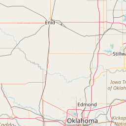
Exact coordinates of the repeater are known.
Coverage circle based on mobile coverage and ignores propagation anomalies and terrain.

Signal Reports (click map icon for details): Base Mobile HT
Add a Signal Report


Call Date Information
KI5EGH (registered) 2023-05-03 updates approved
KI5EGH (registered) 2021-04-27 updated nets. Need to add propagation link for map.
KI5EGH (registered) 2021-03-31 PL changed to 88.5. TSQ of 88.5 added. ARES removed. SKYWARN removed.
KI5EGH (registered) 2021-03-29 Added.
KI5EGH (registered) 2021-03-29 ARES added. SKYWARN added.

(member) on 2021-04-27.

trying to drive traffic

Category Definitions
Comments
Coverage
Activity
Travel
"new repeater"
Posted by: KI5EGH