(1 of 2) ...The Flood Warning continues for the following rivers in Oklahoma... Clear Boggy Creek near Caney affecting Atoka County. * WHAT...Minor flooding is occurring and minor flooding is forecast. * WHERE...Clear Boggy Creek near Caney. * WHEN...Until tomorrow morning. * IMPACTS...At 28.0 feet, Creek levels rise to about 2 feet higher than flood stage in western Atoka County and extreme northeastern Bryan County. High stages on small feeder streams could result in even greater depths to mainstem bottomlands near their points of entry into Clear Boggy Creek. Croplands... pastures... and some secondary rural roads are affected. * ADDITIONAL DETAILS... - At 2:30 AM CDT Wednesday the stage was 28.3 feet. - Bankfull stage is 26.0 feet. - Forecast...The Clear Boggy Creek is expected to fall below flood stage early Thursday morning. - Flood stage is 26.0 feet. - http://www.weather.gov/safety/flood (2 of 2) ...The Flood Warning continues for the following rivers in Texas... Oklahoma... Red River Near Dekalb affecting McCurtain, Bowie and Red River Counties. For the Red River...including Dekalb, Index, Fulton, Shreveport, Coushatta, Grand Ecore...Minor flooding is forecast. * WHAT...Minor flooding is occurring and minor flooding is forecast. * WHERE...Red River near Dekalb. * WHEN...Until further notice. * IMPACTS...At 27.0 feet, Flooding of some two thousand acres of flood plain occur. Ranchers should move livestock and equipment to higher ground. Moderate to severe bank erosion occurs. * ADDITIONAL DETAILS... - At 7:00 PM CDT Tuesday the stage was 25.0 feet. - Bankfull stage is 22.0 feet. - Recent Activity...The maximum river stage in the 24 hours ending at 7:00 PM CDT Tuesday was 25.0 feet. - Forecast...The river is expected to rise to a crest of 26.0 feet tomorrow evening. - Flood stage is 24.0 feet. - Flood History...This crest compares to a previous crest of 25.8 feet on 05/09/1995. - http://www.weather.gov/safety/flood
honey pot Tulsa, CityPlex Towers, Oklahoma, 146.88, WA5LVT Repeater

CityPlex Towers - WA5LVT

Tulsa, OK
Repeater ID: 40-4554

Downlink: 146.88000
Uplink: 146.28000
Offset: -0.600 MHz
Uplink Tone: 88.5
Downlink Tone: 88.5
County: Tulsa
Grid: EM26ab
Call: WA5LVT
Use: OPEN
Op Status: ON-AIR On-Air
Coverage:
Height (ASL): 650 feet
EIRP: 120 watts
Sponsor: TRO inc
FM: Yes; analog capable: 25.0 kHz (wideband)
Notes: Remote receivers in Skiatook (PL 82.5) and east of Owasso on Keetonville Hill (PL 141.3) and CityPlex (PL 88.5). This is a alternate Skywarn repeater for Tulsa County.
Coordination: ORSI
Last updated: 2025-04-22
Last reviewed: 2025-04-22
MarkerMarkerMarkerMarkerMarker
30 km
30 mi
Leaflet © OSM contributors

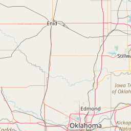
Exact coordinates of the repeater are known.
Coverage circle based on mobile coverage and ignores propagation anomalies and terrain.

Signal Reports (click map icon for details): Base Mobile HT
Add a Signal Report


Call Date Details
KJ5BGQ (registered) 2024-12-31 Propagation Report Added
KC5DJR (registered) 2024-09-29 Propagation Report Added
KC3LLV (registered) 2024-08-11 Propagation Report Added

on 2014-04-20.

Remote receiver in mounds is gone. Has remote receivers in Skiatook and east of Owasso on Keetonville Hill. 141.3 PL activates RX at CityPlex

Category Definitions
Comments
Coverage
Activity
Travel

Posted by: WB5OSM