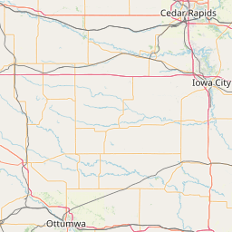
Denison, IA
K0CNM
Repeater ID: 19-87
| Downlink: | 147.09000 |
| Uplink: | 147.69000 |
| Offset: | +0.600 MHz |
| County: | Crawford |
| Call: | K0CNM |
| Use: | OPEN |
| On-air: | |
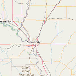
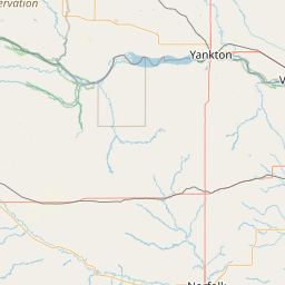
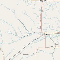
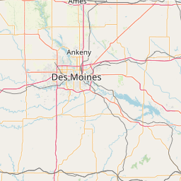
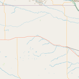
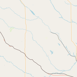
| Coverage: |
Wide Area Coverage: Crawford County, IA <br>
Portions of: Ida County, IA; Shelby County, IA; Harrison County, IA; Carrol County, IA; Sac County, IA Wide area coverage. 30 mi radius. |
| Antenna (AGL): | 150 feet |
| Power: | 50 watts |
| Pattern: | Omnidirectional |
| Features: | Emergency power equipped. |
| FM: | Yes; analog capable: 25.0 kHz (wideband) |
| EchoLink: | 976560 K0CNM-R |
| 👎 Node Offline | |
| Commands: | Touch Tone Commands: 0 8 (Zero Eight) = Link Status # (Pound or Hashtag) = Disconnect Station |
| Notes: | This repeater is not listed in the IARC online database. Likewise, there is no Repeater Record Custodian assigned to this repeater. Please ask KD0E -- RALPH E. GIESMAN --TRUSTEE to register with RepeaterBook.com so that he (or others of his choosing) can be assigned as such. The K0CNM repeater is operated by the Denison Repeater Association. The repeater first went online in 1970. In 2000, the current repeater was purchased from the Iowa Department of Transportation. The repeater was located at the Iowa State Patrol Tower on the west side of Denison, IA on IA-59 North, with an antenna located at 250 feet. The Iowa State Patrol was gracious enough to provide the tower space and a building to house the repeater for years. In 2011 the Denison Repeater was taken offline and moved to a temporary location at the home QTH of KD0E, as the Iowa Department of Safety needed more tower space for their own equipment as they upgraded. In November 2013, the repeater finally found itself a new home located on a public safety tower just north of Denison, IA with current antenna at 150 feet. On Friday 05 January 2024, an email from KB0PRL -- BYRON J. VENNINK -- 1599 PANORA AVE -- WOODBINE, IA 51579 USA: was received by RB Administration: Email: bvennink@harrisoncountyparks.org Callsign: KB0PRL Msgbody: "Denison Iowa 147.090 has not been in operation for years." If you have heard of this repeater or know of its actual Operational Status, please email directly to KV4VT@RepeaterBook.com ASAP. |
| Last updated: 2024-01-06 | |
| Last reviewed: 2024-01-06 | |


Exact coordinates of the repeater are
not known.
Coverage circle based on mobile coverage and ignores propagation anomalies and terrain.
Nets Monday Wednesday Friday at 8:30pm, Website www.K0CNM.org, Echolink Node # 501320
Activity
Travel
Posted by: KD0MYU