(1 of 3) ...The Flood Warning continues for the following rivers in Oklahoma... Clear Boggy Creek near Caney affecting Atoka County. * WHAT...Minor flooding is occurring and minor flooding is forecast. * WHERE...Clear Boggy Creek near Caney. * WHEN...Until tomorrow morning. * IMPACTS...At 29.0 feet, Creek levels rise to three feet higher than flood stage in western Atoka County and the northeastern edge of Bryan County. High stages on small feeder streams result in even greater depths to mainstem bottomlands near their points of entry into Clear Boggy Creek. Croplands... pastures... and some secondary rural roads are flooded. * ADDITIONAL DETAILS... - At 1:30 PM CDT Tuesday the stage was 28.5 feet. - Bankfull stage is 26.0 feet. - Forecast...The Clear Boggy Creek is expected to fall below flood stage just after midnight tonight and continue falling. - Flood stage is 26.0 feet. - http://www.weather.gov/safety/flood (2 of 3) ...The Flood Warning continues for the following rivers in Oklahoma... Cimarron River near Waynoka affecting Major, Woods and Woodward Counties. * WHAT...Minor flooding is occurring and minor flooding is forecast. * WHERE...Cimarron River near Waynoka. * WHEN...Until tomorrow morning. * IMPACTS...At 8.0 feet, Bankfull conditions exist along the river... and some overflows may occur over some low-lying areas near the river. The river reach affected extends from near Freedom upstream... to the U.S. Highway 281 crossing south of Little Sahara State Park near Waynoka... to near Orienta in Major County. * ADDITIONAL DETAILS... - At 1:30 PM CDT Tuesday the stage was 8.2 feet. - Bankfull stage is 8.0 feet. - Forecast...The Cimarron River is expected to fall below flood stage just after midnight tonight and continue falling. - Flood stage is 8.0 feet. - http://www.weather.gov/safety/flood (3 of 3) ...The Flood Warning is extended for the following rivers in Oklahoma...Texas... Red River Near Dekalb affecting McCurtain, Red River and Bowie Counties. For the Red River...including Dekalb...Minor flooding is forecast. * WHAT...Minor flooding is forecast. * WHERE...Red River near Dekalb. * WHEN...From this evening to Saturday evening. * IMPACTS...At 24.5 feet, Flooding will continue to decrease along the Red River, although bank erosion problems will continue. Minor overflow of low banks will continue, especially on the Oklahoma side of the river. * ADDITIONAL DETAILS... - At 9:00 AM CDT Tuesday the stage was 22.8 feet. - Bankfull stage is 22.0 feet. - Forecast...The river is expected to rise above flood stage late this evening to a crest of 25.0 feet early Thursday afternoon. It will then fall below flood stage early Saturday morning. - Flood stage is 24.0 feet. - Flood History...This crest compares to a previous crest of 25.0 feet on 01/07/1998. - http://www.weather.gov/safety/flood
honey pot Bartlesville, Oklahoma, 146.76, W5NS Repeater

Bartlesville, OK

W5NS
Repeater ID: 40-4331

Downlink: 146.76000
Uplink: 146.16000
Offset: -0.600 MHz
Uplink Tone: 88.5
Downlink Tone: 88.5
System Fusion Enabled
DG-ID:
WIRES-X: 50510 No matching ID is currently active.
Reflector: None found
County: Washington
Grid: EM26ar
Call: W5NS
Use: OPEN
Op Status: ON-AIR On-Air
Coverage: 25 mi radius.
Sponsor: Bartlesville Amateur Radio Club
FM: Yes; analog capable: 25.0 kHz (wideband)
Coordination: ORSI
Last updated: 2023-08-29
Last reviewed: 2024-12-10
Marker
30 km
30 mi
Leaflet © OSM contributors

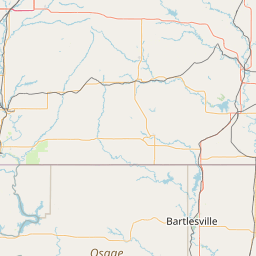
Exact coordinates of the repeater are known.
Coverage circle based on mobile coverage and ignores propagation anomalies and terrain.

Signal Reports (click map icon for details): Base Mobile HT
Add a Signal Report


Call Date Details
KE9XB (registered) 2024-12-10 Reported no changes
KE9XB (registered) 2023-08-27 Updated per request

(member) on 2023-08-27.

The W5NS 146.76 repeater is now back on-line. It was repaired and there is another signal source that seems to be interfering only at night. Suspect another repeater.

Category Definitions
Comments
Coverage
Activity
Travel
"146.76 Status"
Posted by: KE9XB